More information about the project is found here:
11-15-11
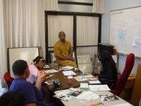
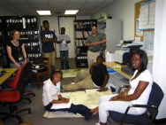
ITSRG will collaborate with the launch of the Urban Apps and Maps Studio - a new project funded by the U.S. Economic Development Administration. The grant aims to build a sustainable ecosystem for urban development through launching an Urban Apps & Maps Studio. The Studio will be a hub for creating software applications, maps, and data sets to solve economic problems in Philadelphia and other cities in the Northeastern U.S. It will connect one of the largest groups of information technology users – high school and college students – with urban entrepreneurs; community, civic and government organizations; and faculty to develop and commercialize the Apps & Maps designed by the Studio. The ultimate goal of the program is to stimulate economic development, job creation, and business ventures in under served areas of Philadelphia and beyond. ITSRG's director, Michele Masucci is the project Co-P.I.
More information about the project is found here: 11-15-11
1 Comment
Chris Harper Resource Link
www.philadelphianeighborhoods.com Provocative Question: Most Philadelphia neighborhoods only see journalists when bad news happens. How can people take control of the news and information for and about their neighborhoods for the betterment of their communities? Mark Saltzer and Arlene Solomon Resource Link www.tucollaborative.org Rena Krakow Resource Link http://www.temple.edu/chpsw/departments/commsci/KidsWrite_HomePage.htm Joyce Joyce Provocative Question: What do contemporary Black poets have to say about the ism's that are now all socially constructed? Middle Passage: http://www.youtube.com/watch?v=P98JZhWUijY Peace: http://www.youtube.com/watch?v=Q4s8RH4nQGc Furious Flower: http://www.youtube.com/watch?v=Xf1duFaC2E4 Trish Jones Resource Link www.creducation.org Seth Bruggeman Resource Link Germantown Windshield Tour http://www.youtube.com/watch?v=tmN6kNm-_bE The Wagner Free Institute of Science--What's In There? http://www.youtube.com/watch?v=a1ONeAqIm7g&feature=related Rethinking the Past at Historic Cliveden http://www.youtube.com/watch?v=ReXZnAGTmCM First Person Museum http://www.youtube.com/watch?v=g0OWhuf61Lc We are busy planning the start of BITS 2010 summer programs. We invite all former BITS Program participants to consider joining us again this year. We are part of the Work Ready programs for Philadelphia this year. Youth aged 14-24 are eligible to apply via a new online website:
https://summerapp.workreadyphila.org/ The program begins on Tuesday, July 6 and ends Friday, August 13, 2010. Participants can enter either a service learning or internship program model. Internships are reserved for college-bound juniors and seniors. The BITS 2010 Service Learning theme is Exploradelphia! Participants will gain an opportunity to learn about historic, environmental, and cultural landscapes throughout the city with an emphasis on the city's natural environments and human-environment problems. Students will work in teams of 10 with Temple University mentors to visit, document, and create web content about the places they visit and explore. Students will create community accessible collections of content that can support local environmental quality and development goals as part of their summer long service learning project. BITS Interns will have the opportunity to work on environmental problems through placements in research labs, libraries, institutes and projects on Temple University's Main and Health Sciences Campuses. Students will gain an understanding of the day to day activities in these settings, work place expectations, and technology and research skills. For more information about BITS 2010 contact our staff at [email protected] or 215-204-4513 Michele Masucci Director, ITSRG Digital Mapping is a new general education course being offered at Temple University. Undergraduate students can take this course to fulfill a quantitative literacy requirement that all students must fulfill. The course offers students the opportunity to gain an understanding of the relationships between spatial information, digital technologies for earth observation, traditions for visualizing and representing spatial information in map forms, and experiences in field observations, wayfinding, and making maps. Faculty in Temple University's Geography and Urban Studies department are providing the instruction for the course. A number of online resources have been developed to provide students with a comprehensive view of the world wide web of digital maps.
Here are two resources that are being updated on a regular basis in connection with the course: Digital Mapping Blog: http://digitalmappingblog.blogspot.com This blog features weekly updates related to course lectures, related readings, and map making technologies and examples of interest to students as well as the general public. Hamil Pearsall's Digital Mapping Bundle: http://delicious.com/hamil.pearsall This Delicious book mark bundle provides a comprehensive set of links to more resources for digital mapping students and enthusiasts. Michele Masucci, Director ITSRG Temple University BITS Summer Intensive Program focused on helping high school students from Philadelphia to examine local environmental and economic concerns. One technology task that students engaged was to create maps to represent places they visited, described and depicted with photographs, reports, podcasts, and projects. Below are a collection of maps created by BITS participants throughout the summer. _____________________________ The Next Generation of Bikes group created two maps. The first, shown to the left, illustrates the setting and specific locations of bike racks throughout Temple University's main campus. The second, shown below, depicts the locations of bike repair shops throughout Philadelphia. The project was part of an internship with Temple University's new Bike Temple program that aims to provide Temple students and staff with low cost bikes, resources to repair bikes, and information about safe bike commuting. A highlight of the summer program was participating in group rides to make assess locations and paths that foster safe commuting throughout campus. The Ebony Past to Present group worked in Temple University's Blockson Collection all summer reviewing and reporting from Ebony Magazine archives. The students focused on innovators and artists featured in the series. Students created a map that showed locations where innovations featured in Ebony first appeared. The markers are noted with information about the key figures related to the innovations; and the markers are color coded to reflect the type of innovation featured on the map. The Environmental Research Forum group created this map depicting locations on Temple University's Main Campus where the BITS Program was held throughout the summer. Locations featured on the map have photographs taken by students, along with brief notes about environmental themes in those settings. This group reported on all of the green internship and program initiatives throughout the summer. BITS Program Participants are shown here working in the Social Science Data Library (SSDL) with Graduate Coorinator Kelly George. This group's blog is called Mapping our Future. Students work are working on a map cataloging and archiving project supervised by David Ford of SSDL. BITS Program participants are busy working on social media projects that depict the projects they have been working on this summer. Students are creating blogs, powerpoint presentations, podcasts, and slide shows related to many different environmental themes. These will be shared in showcase events planned for next Friday, August 14, on Temple University's Main Campus, located on Avenue of the Arts North. In addition to the showcases on Friday, some students will participate in a Mock Trial on Wednesday and others will host an exhibit of local artist Walter Gholson's work on Wednesday and Thursday of next week.
Service Learners are focused on designing new and improved trail entrances to the Wissahickon Park. These designs reflect what they observed on several park visits about the park users. The students found that very few hikers use the lower trail in comparison to cyclists and runners during the early afternoon hours. However, the diversity of uses was evident. In addition to hikers, runners and cyclists, students discovered many fishers on sunnier days. Interns are blogging about their daily activities and preparing for the showcase events that will be held throughout next week. They are also completing career portfolios that include resumes, samples of their work, and reflections of their strengths and skills in the workplace. Here are links to the internship team blogs: http://secondlifeandafricanamericanhistory.blogspot.com/ http://phillygreen.blogspot.com/ http://templeengineer.blogspot.com/ http://phillygreen09.blogspot.com/ http://pevywp.blogspot.com/ http://bitsmocktrial.blogspot.com/ http://ebonypast2present.blogspot.com/ http://seniorsafety09.blogspot.com/ http://greenworldchanges.blogspot.com/ http://mappingourfuture.blogspot.com/ http://tngob09.blogspot.com/ BITS Program events and times will be announced soon! Stay tuned for particulars! Michele Masucci Director, ITSRG - Temple University BITS Program participants are walking Philadelphia, braving heat and sun, to examine landscapes of Fairmount Park. On Temple University's Main Campus, they are wearing their new Temple IDs to work in computer labs, libraries, classrooms, and offices as interns and as service learners. They are charged with creating social media projects related to environmental issues and to depict the observations they are making on their field assignments. Kevin Groves of Friends of the Wissahickon orienting
BITS participants to their upcoming visit to the park Local Artist, Walter Gholson, meets with BITS Interns to discuss his artwork and plan the creation of a showing and gallery space in the ITSRG workroom. He creates mixed media, print, collage, and painted works. He helped the students to create collages during his first visit with the group last week. The Rocky statue at the foot of the Art Museum was a favorite destination for Service Learners to stop, catch a little shade, and pose for a group photo. This marks the half-way mark for their three-mile long Benjamin Franklin Parkway loop. Students are examining the Parkway design, history, and uses as part of a month long set of field trips to various locations in the Fairmount Park system. BITS Interns are working in research, data, and library settings across the university. They are working on Temple's new bike program, it's inventory of sustainable practices, cataloging maps and archives, creating social media projects, and reviewing environmental law case studies. This week, BITS Participants are walking the Benjamin Franklin Parkway with digital cameras and clipboards in hand. They are examining three aspects of this iconic Philadelphia landscape. First, they are searching for unexpected features, unique historical and cultural juxtapositions, signs of competing uses, and the use of symbols to represent Philadelphia's urban identity and history. Second, the BITS team is examining the design and environmental characteristics of the Parkway. Finally, they are assessing the relationship between the pedestrian and transportation modalities of the space. ITSRG has been examining web-maps during the past year. There have been two aspects of web maps we find of interest. First, we are interested in the data that is being visualized by the map. Second, we are interested in who is contributing to the data sets and the content of comments related to the maps that are disseminated. We have created a separate page for maps we have featured in blog posts called WebMaps. You can explore our archived comments about featured maps there. Official Map of Michigan? State of Official State Map: Click on the map to read a short Associated Press story which illustrates that maps matter. A lawmaker in Michigan is pushing a policy that requires all state maps to include both the lower and upper parts of the state, not just the lower part shown in the image above. LAPD Interactive Crime Map Crime Map Controversy: This map created by the Los Angeles Police Department has sparked public controversy because there are disputes over the data represented. Many claim that crimes are underreported, and therefore provide misleading content about the safety in different sections of the city. Read more about the issue here. NYT Broad Unemployment New York Times Maps Broad Unemployment: Today's New York Times map of broad unemployment by state reflects what many economists have been concerned about for months - that full-time unemployment rates do not reflect the true impacts families are experiencing, because there are many who have simply given up looking for jobs and others who cannot find full time work and therefore settle for part-time positions. This map allows shows both the conservative and the more complete estimates of unemployment by state. Michele Masucci, Director ITSRG - Temple University |
ITSpace: Geographies Flickr BITSArchives
November 2011
BlogrollBest Green Blogs Categories
All
|