On behalf of the Information Technology and Society Research Group of Temple University, we wish to express sincere thanks to the geo-blogging community for following ITSpace during the past six weeks as we have called attention to growing trend for citizens to share spatial information using web 2.0 applications. In particular, we wish to give a special thanks to the folks at Very Spatial for calling our series to the attention of their readers and pod cast audience. We are grateful for the insightful comments shared by the professional geographers across the country and members of online map user communities. Thank you also for the contributions of guest authors David Organ and Paul Schroeder. We will continue to welcome guest authors to post new discussions, so please do not hesitate to contact us about new post ideas related to the theme of Citizen Cartographers in the future.
Citizen Cartographers theme posts have highlighted examples of citizen involvement in creating and sharing maps online, the use of online map tools by citizens and advocacy groups, and the concerns citizens may have in how online spatial information may affect them on the ground. We have suggested that the magnitude of this trend warrants the attention of geographers, cartographers, community advocates and others to enter into a public conversation about the impact of the Internet on sharing spatial information, collaborating to create spatial data sets, geo-visualization and map making, and using maps. One of the challenges that we face in doing so is how to foster and engage a conversation that is relevant with respect to the rise of citizen cartographers and their concerns.
Now that citizen involvement in cartography is web-enabled, the participatory impact and geographic dissemination of projects engaged by citizens and in the public domain is greatly expanded. Maps as literal and metaphoric tools for illustrating community concerns, depicting contested spaces, visualizing analyzed geographic problems, and showing where the thing occurs are one of the oldest artifacts of geographic inquiry and representation. We have suggested that what makes the emergence of web 2.0 tools for creating maps intriguing is the ways in which collaboration, distance, and dissemination are mitigated for content creators.
Our examination has also led us to theorize about how collaborative cartographic practices are redefining the focus of geographic inquiry and cartographic representation. The professional practice of cartography involves using skillful design techniques to locate and visualizing geographic information, define and classify geographic data sets, align those datasets with graphical representation traditions and formats, and critically examine what is communicated on maps. Many scholars have pointed out that embedded within the practice of cartography are political and ethical concerns. Maps can be artifacts of power relations (such as political redistricting maps) as well as tools for mitigating power among groups (such as zoning maps). Maps can be representations of places and they can be manifestations of how people identify themselves.
The traditional study of maps is quickly being supplanted by the rapid creation of maps (or maps-of-a-sort). Many web applications that permit collaborative mapping are quite simplistic in terms of how spatial data are represented. Most mash ups approaches supported by online map applications use simple x-marks-the-spot tools for geo-tagging features. Attributes can be attached to the point (line or area) markers with most of these applications. Most online map applications also support collaborative approaches that enable more than one contributor to create the spatial data set. This aggregation of spatial data through the inclusion of collaborators is one of the unique features of the process of online mapping, and represents one of the most important divergences from prior cartographic practices. Users can e-collaborate to generate data in virtually real time, so that the spatial data set itself is unbounded at the onset of creating the map. Most professional cartographers are accustomed to mapping a temporally static spatial data set.
More sophisticated forms of geovisualization, such as representing classes of spatial information, showing proportional representations over space, or creating isometric lines of equal value to model distributions of spatial information are not yet the domain of online cartography collaborations. Instead, the underlying objective of web-enabled citizen cartographic activities lies in two main areas: (a) participating to create and share new content that cannot be shared or accessed otherwise and (b) tailoring existing (online) content for new audiences and new purposes through adding new media components.
We suggest that a new research direction related to citizen cartographers and the cartographic products they create would focus on issues related to their participatory processes, the transparency and fairness of information practices, the privacy implications of citizen cartographic practice, the use of data sets and maps created through e-collaborative processes, and the implications of a proliferation of user defined content.
We will begin to explore these issues through the startup of an informal science education demonstration project that involves citizens in Philadelphia and other cities to map and share their walking and rolling routes using online social media applications. The project will be implemented in the Fall of 2008, with more details to come soon about how to participate.
Michele Masucci
Caroline Guigar
Temple University
|
0 Comments
BITS Summer Program 2008 is underway throughout the month of July. This year we are providing students with research and field experiences and information technology skills in mapping historic markers related to the African American experience in Philadelphia. 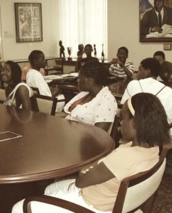 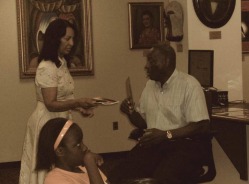 This summer, our students are focused on creating web-interactive maps of the entire marker collection documented by Dr. Blockson. Dr. Blockson has spent a great deal of time helping our students to understand the politics of marking by sharing some of the stories related to how and why specific settings are ultimately chosen to receive an official state historical marker. They have found that there is no single consolidated listing of markers, since more than one institution has programs to place markers at historical sites. And, since the various marker programs do not create meta-tags denoting categories for inclusion, it is difficult to search for maps of markers online. Here is the map one of our students, Hazreena Ali, has created drawing from Mr. Blockson's book detailing sites related to African American history designated by the State of Pennsylvania to be of interest within Philadelphia. One interesting example of a setting that has been given a state historic marker is the Legendary Blue Horizon, located on North Broad Street, just a few blocks from Temple University's Main Campus. Many of the greatest boxers of the last century have fought and trained at the Blue Horizon. Surprisingly little information about it is found online, and even less is noted on the marker outside. Our approach for providing students with an understanding of its historical and cultural significance within the African American community of Philadelphia and beyond has been to visit, photo-document, and map the location during the past four years. Through this process, our students have come to understand that it is a living legacy that continues to host world-renowned boxing events, and that its owners are striving to compile archives of its historical significance and share them with the public. Newspaper clippings are framed behind the venue manager's desk, shown here in a photo taken by students in the BITS Program during the summer of 2006. Over the past year, various Web 2.0 technology platforms have begun to provide its users with the ability to connect content they have created with a location, thus enabling not only keyword searches but location-based searches. This experience has been further enhanced through geoRSS feeds and geotags which integrate technologies such as Twitter and Flickr with online mapping sites such as Google and Yahoo Maps. Thanks to Temple's IT and Society Research Group (ITSRG) for creating a space for "citizen cartographers" to show their work. I hope this opportunity continues beyond June into the coming months. |
ITSpace: Geographies  Flickr BITSArchives
November 2011

BlogrollBest Green Blogs Categories
All
|
 RSS Feed
